MARMARIS GUIDE
Bozburun Peninsula Guide: Selimiye, Kızkumu, Turgut Waterfall and Bozburun
Last updated: 31 October 2026
Share this guide
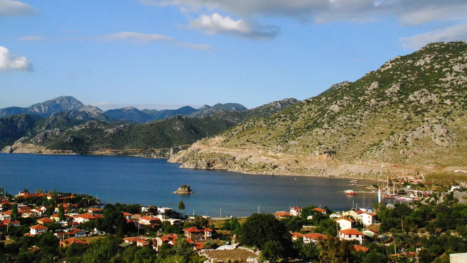
The Bozburun Peninsula stretches south-west of Marmaris with pine forest, quiet bays and small fishing villages. Kızkumu's sand path through the sea, Turgut Waterfall, Selimiye's waterfront, Bozburun's gulet yards and the sunset at Söğüt all lie on the same road. Sources give anything from 35 to 50 km for Selimiye; we measured every stop with two separate routing services. Here you will find the two roads in, what to do at each stop, the ancient sites, which places you reach by car and which only by boat, driving tips and ready-made routes.
At a Glance: the Bozburun Peninsula
- Marmaris → Selimiye
- About 45 km, 45–63 minutes
- Marmaris → Bozburun
- About 53 km, 52–75 minutes
- Marmaris → Kızkumu
- About 28 km, 29–36 minutes
- Highlights
- Kızkumu, Turgut Waterfall, Selimiye waterfront, Bozburun gulet yards, Söğüt sunset
- Full-day loop
- About 105–120 km; well within the 300 km daily allowance
- Protection
- Datça–Bozburun Special Environmental Protection Area (1990)
Quick Plan: Stops, Distances and Drive Times
Distances and times are one-way drives from Marmaris centre (Netsel Marina), measured with two routing services. The peninsula roads are winding; breaks and summer traffic are not included.
| Stop | From Marmaris | Drive | What's there? |
|---|---|---|---|
| Hisarönü | 22 km | 21–25 min | Shallow sea, red sand, windsurfing |
| Orhaniye and Kızkumu | 28 km | 29–36 min | A sand path through the sea |
| Turgut Waterfall | 35–36 km | 39–52 min | Cascades and a pool |
| Selimiye | 45 km | 45–63 min | Waterfront, restaurants, boat trips |
| Bozburun | 53 km | 52–75 min | Gulet yards, harbour |
| Söğüt | 57 km | 54–84 min | Sunset, views over the Sömbeki Gulf |
| Taşlıca | 5 km from Söğüt | 7–10 min | Stone village at the end of the road |
| Bayır | 28–42 km | 43–58 min | Ancient plane tree in the square |
The stops up to Selimiye are very close together: Hisarönü to Kızkumu is about 7 km, Kızkumu to Turgut about 5 km, Selimiye to Bozburun about 9 km and Bozburun to Söğüt about 9 km. So the peninsula can be seen in one day or spread over two.
A day trip by car around the peninsula
The full-day loop is about 105–120 km, well within the 300 km daily allowance. Collect the car at your hotel and return it there.
How to Get to the Bozburun Peninsula from Marmaris: Two Roads
There are two roads onto the peninsula. Which one to take depends on where you want to go first.
- Via Hisarönü (main road): at about km 22 of the Marmaris–Datça road, turn left at the Hisarönü junction; the road passes Orhaniye, Kızkumu and Turgut and runs down to Selimiye. Selimiye is about 45 km and 45–64 minutes away. Kızkumu and Turgut Waterfall are on this road, so it is the easiest choice for a first visit.
- Via İçmeler and Bayır: shorter to Selimiye at about 39 km, but more winding and slower; maps show 56–82 minutes. Good if you want to see the plane tree at Bayır or come back a different way.
- Minibus (dolmuş): MUTTAŞ runs lines from Marmaris to Kızkumu and Turgut Waterfall, to Selimiye and Bozburun via Turgut, and to Söğüt via Bayır; no line to Taşlıca is listed. Timetables change with the season, so always check the last return time.
To see several stops in one day, stay as long as you like at the waterfall or at Kızkumu and drive back in daylight, a hire car is the most flexible way.
Open Marmaris – Kızkumu – Selimiye directionsHisarönü: Gateway to the Peninsula
Hisarönü is the first stop after you leave the Datça road. According to Marmaris municipality's description, its sea is shallow, its sand is the colour of terracotta and it is counted among the best windsurfing spots around Marmaris. About an hour's climb from the plain takes you to the ancient sanctuary of Kastabos, with the foundations of the 4th-century BC Temple of Hemithea and a ruined theatre.
For the village itself and car delivery, see our Hisarönü page.
Kızkumu Beach: A Sand Path You Walk Through the Sea
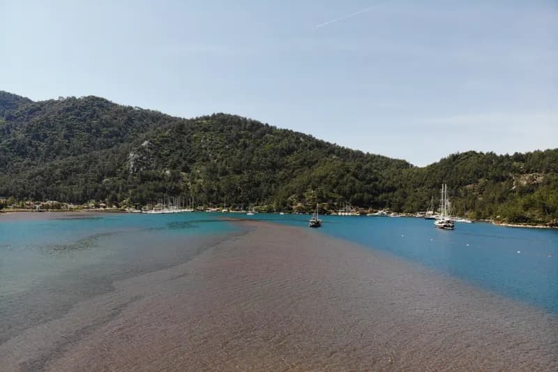
Kızkumu is a shallow strip of sand at Orhaniye that runs out into the sea and splits the bay in two. Publications of Marmaris municipality and the Muğla Directorate of Culture and Tourism give its length as about 600 m; according to NTV the natural path through the sea is about 3 metres wide. It was formed by sand and gravel building up over time. You can walk towards the middle of the bay in water that barely reaches your ankles; there is gravel in places, so water shoes help.
Its name comes from a legend, which is told in several versions. In the best-known one, a girl trying to reach her lover walks into the sea pouring sand from her skirt and drowns when the sand runs out. The statue of a girl at the start of the strip was made after this legend; it is a story, not history.
Orhaniye is one of the main yacht stops in the Gulf of Hisarönü and its sea is usually calm. The castle ruins on the islet in the middle of the bay are thought to belong to ancient Bybassos.
For details on Orhaniye and Kızkumu see our Orhaniye and Kızkumu page, and for other beaches our guide to the best beaches and bays around Marmaris.
Open Kızkumu Beach on the mapTurgut Waterfall: A Cool Break in the Pine Forest
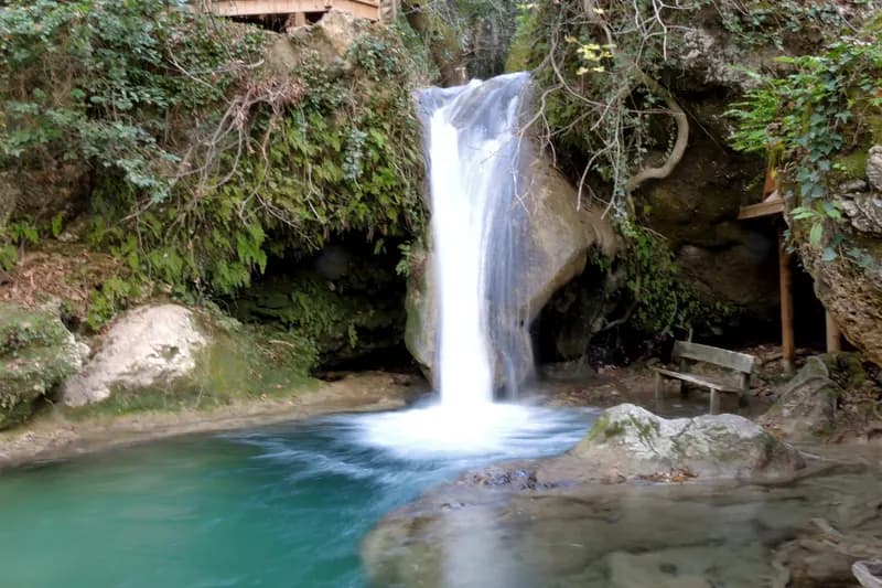
Turgut Waterfall is a picnic spot near Turgut village, about 10 km from Kızkumu, surrounded by pine and sweetgum trees. The Muğla Directorate of Culture and Tourism describes it as five waterfalls one after another, with a cool pool below. In summer it is one of the most visited places on the peninsula to cool off.
Near Turgut there is a pyramid-shaped tomb which, according to its inscription, belonged to a warrior called Diagoras in the 3rd century BC. Turgut village itself has been declared a protected site for its historic and natural value.
For the village and car delivery, see our Turgut page.
Open Turgut Waterfall on the mapSelimiye: Waterfront, Bays and Ancient Hydas
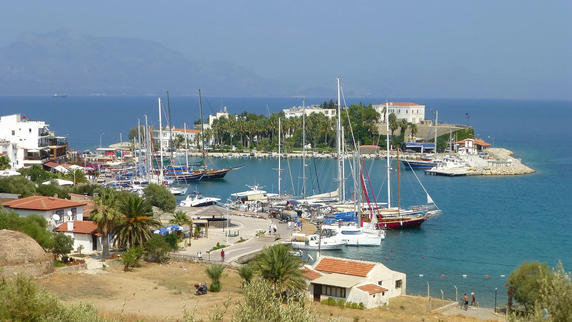
Selimiye is a quiet village inside the Gulf of Hisarönü, known for the small restaurants and boutique hotels along its shore, and an important stop on the blue-cruise route between Bodrum and Marmaris. It is said to have been called Losta in the Byzantine period and to take its name from Sultan Selim I.
There is no sandy beach in the village itself; people swim from the jetties along the shore, and the nearest sandy beach is Sığ Liman, about 2 km away. On the hills behind the village are the Hellenistic wall remains of ancient Hydas. Boats from Selimiye go to Kamelya (Kameriye) Island, known for its monastery ruins and pebble mosaic, and to Dişlice Island.
- In early February the almond trees around the village are covered in white blossom.
- The second Seafood Festival organised by Marmaris municipality was held on Selimiye's waterfront in early October 2026; check the municipality for next year's dates.
For the village itself and car delivery, see our Selimiye page.
Bozburun: Gulet Yards and the Sömbeki Gulf
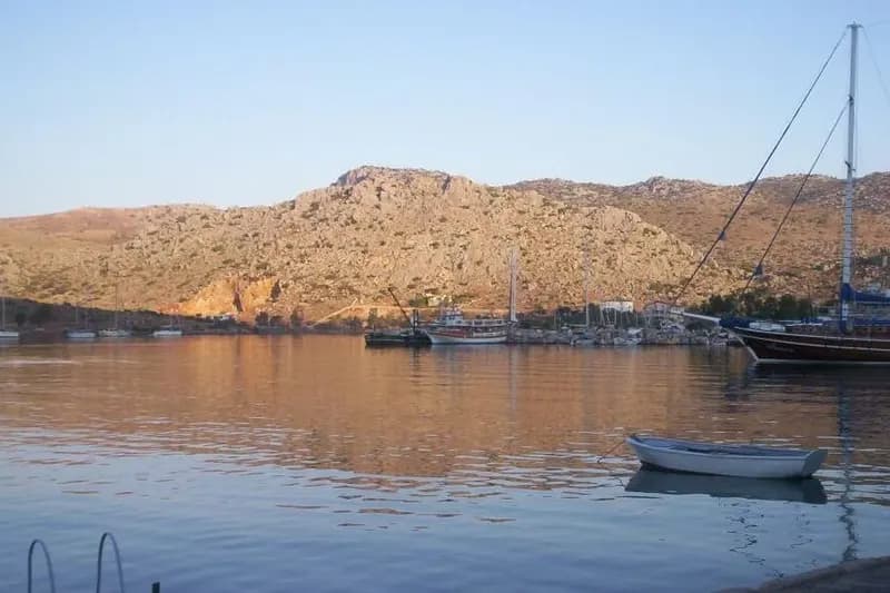
Bozburun, on a cove of the Sömbeki Gulf, is the village that gives the peninsula its name. The Muğla Directorate of Culture and Tourism presents it for its yacht building and master boat builders; according to Marmaris municipality you can see gulets being built on the slipways of the small yards along the shore. Its economy rests on yachting and tourism, partly on fishing.
Around the harbour there are small hotels and fish restaurants, and Bozburun's thyme honey is well known. The remains of ancient Larymna lie on Asar Tepe, north-east of Bozburun.
For Bozburun itself and car delivery, see our Bozburun page.
Open Marmaris – Bozburun directionsSöğüt and Taşlıca: Sunset at the End of the Peninsula
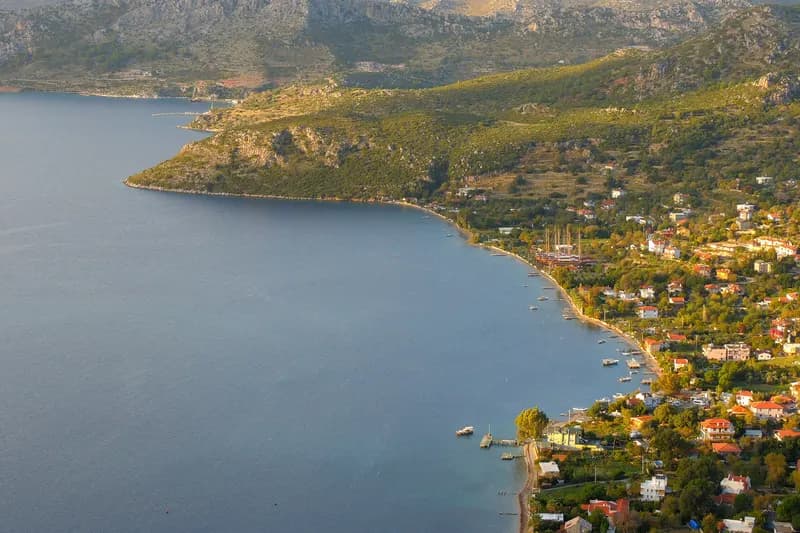
Söğüt's old name is Saranda. Marmaris municipality recommends watching the sunset over the Sömbeki Gulf and the island of Symi from Saranda. The village once lived from farming, seafaring and trade with the islands, and took up sponge diving after the Second World War; it is known for broad beans and carob molasses. On the hill behind the school you can see the wall fragments and foundations of unexcavated ancient Thyssanos. Boat trips from Söğüt go to bays such as Söğüt Island and Üç Taş.
Taşlıca, about 5 km beyond Söğüt, is the village farthest from Marmaris. A narrow paved road climbs to it; it is known for rocky slopes, giant olive trees, stone houses and goat herds. Locals still call it Fenaket. On Asar Tepe outside the village lies ancient Phoenix, reached by a footpath of about 4 km.
From Taşlıca a dirt road of about 8 km runs down to Serçe Limanı. The 11th-century wreck with a cargo of glass found there is displayed at the Bodrum Museum of Underwater Archaeology.
For Söğüt itself and car delivery, see our Söğüt page.
Open Marmaris – Söğüt directionsBayır: The Ancient Plane Tree and the Village Square
Bayır lies on the second road, via İçmeler, and is the stop for those who drive back that way. The great plane tree in the village square is one of the symbols of the area; different estimates of its age are given, and its exact age is not known. The village is known for olive oil, honey and bay laurel. The remains of ancient Syrna lie about 2 km north-east of Bayır cove.
For Bayır and car delivery, see our Bayır page.
Ancient Sites of the Bozburun Peninsula
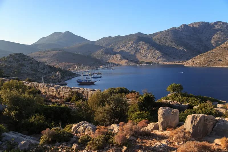
The peninsula was part of the coastal area of ancient Caria tied to Rhodes. The Muğla Directorate of Culture and Tourism lists the places below as undeveloped archaeological sites: there is no ticket office or laid-out path, and most are reached on foot or by boat.
| Ancient site | Where? | How to get there |
|---|---|---|
| Kastabos (Temple of Hemithea) | Hisarönü, Pazarlık | About a 1-hour walk from the plain |
| Bybassos | Hills around Orhaniye and Hisarönü | On foot; island castle by boat |
| Hydas | Hills between Turgut and Selimiye | On foot |
| Larymna | North-east of Bozburun, Asar Tepe | On foot |
| Thyssanos | Söğüt, hill behind the school | About 45 min on foot; unexcavated |
| Phoenix | Taşlıca, Asar Tepe | Footpath of about 4 km |
| Loryma (Bozukkale) | Southern tip of the peninsula | Best by boat; very hard by land |
Loryma's harbour fortress is well preserved; it is about half an hour by small boat from Serçe Limanı. For ancient Amos near Turunç see our Kumlubük and Amos page. If you go walking, take water, a hat and sturdy shoes, and don't walk at midday in summer.
By Car or by Boat? How to Reach Each Place
Some of the loveliest corners of the peninsula have no road. Knowing this when you plan saves time:
| Place | Access | Note |
|---|---|---|
| Kızkumu, Selimiye, Bozburun, Söğüt | Car | Paved road |
| Turgut Waterfall | Car and a short walk | On the road |
| Taşlıca | Car | Narrow paved road |
| Serçe Limanı | Car (dirt road) or boat | About 8 km of dirt road from Taşlıca |
| Kamelya and Dişlice islands | Boat | By boat from Selimiye |
| Söğüt Island, Üç Taş | Boat | On boat trips from Söğüt |
| Loryma (Bozukkale) | Boat | Very hard to reach by land |
| Kastabos | On foot | About 1 hour from the Hisarönü plain |
Ready-Made Routes: Half Day, Full Day and Two Days
The routes start and end in central Marmaris. Distances and times are rounded and cover driving only; breaks are not included.
Half day: Kızkumu and Turgut Waterfall
Marmaris → Kızkumu → Turgut Waterfall → Marmaris
- Distance
- About 70 km
- Driving
- About 1.5–2 hours
- Trip length
- Half day
Best for: Short on time, families
Walk Kızkumu early in the morning, then move on to the cool of the waterfall towards midday. You are back in Marmaris by the afternoon.
Full day: round the peninsula
Marmaris → Kızkumu → Turgut Waterfall → Selimiye → Bozburun → Söğüt → Bayır → Marmaris
- Distance
- About 105–120 km
- Driving
- About 2–3.5 hours
- Trip length
- Full day
Best for: First-time visitors
After Kızkumu and the waterfall, have lunch in Selimiye, see the harbour and yards in Bozburun and take in the view at Söğüt. Drive back via Bayır and finish the winding road before dark.
Two days: with a night in Selimiye
Day 1: Marmaris → Kızkumu → Turgut Waterfall → Selimiye · Day 2: Bozburun → Söğüt → Taşlıca → Bayır → Marmaris
- Distance
- About 115–130 km
- Driving
- 1–2 hours a day
- Trip length
- Two days
Best for: Those who like to take it slowly
Spend the first evening on Selimiye's waterfront; next morning you can take a boat trip to the islands. On day two drive down to Taşlıca and come back via Bayır.
Do the route on your own schedule
Stop wherever you like without depending on minibus times. Choose your dates and see the price straight away.
Driving on the Peninsula: What to Know
When to Visit the Bozburun Peninsula
Summer is the liveliest time; in July and August the bays and roads are busy. June and September are calmer. In early February Selimiye's almond trees blossom, and a Seafood Festival was held in Selimiye in early October. In winter the villages go quiet; ask in advance whether restaurants and hotels are open.
The Bozburun Peninsula by Hire Car
- Pickup point: in central Marmaris, at hotels and in İçmeler you can collect and return the car free of charge. If you are staying on the peninsula we also bring the car to Hisarönü, Orhaniye, Turgut, Selimiye, Bayır, Bozburun and Söğüt; delivery to these points has a fee, shown on the booking screen.
- Kilometres: the full-day loop is about 105–120 km; the standard allowance is 300 km a day.
- Credit card and deposit: a credit card is not required and the deposit can be paid in cash. All conditions are on the Rental Terms page.
- A small car: a small car makes the narrow village roads and waterfront parking easier.
For current prices see our Marmaris car hire prices guide, and for delivery points our Delivery Points page. For more places nearby, have a look at things to do around Marmaris by car and our Datça road guide.
Distances and times are approximate and vary with traffic and season.
Share this guide
Frequently asked questions
How far is Selimiye from Marmaris?
Selimiye is about 45 km from Marmaris centre via Hisarönü; the drive takes 45–63 minutes. The İçmeler–Bayır road is shorter at about 39 km but more winding.
How far is Bozburun from Marmaris?
Bozburun is about 53 km from Marmaris centre; the drive takes 52–75 minutes. Selimiye and Bozburun are about 9 km apart.
Where is Kızkumu and how long is the sand path?
Kızkumu is at Orhaniye, about 28 km from Marmaris. Official publications give the sand strip as about 600 m long; you walk on it in water that barely reaches your ankles.
What is the legend of Kızkumu?
The legend is told in several versions. In the best-known one, a girl trying to reach her lover walks into the sea pouring sand from her skirt and drowns when the sand runs out. The statue at the start of the strip was made after this legend.
How do you get to Turgut Waterfall?
The waterfall is near Turgut village, about 35–36 km from Marmaris and about 10 km from Kızkumu. It is 39–52 minutes by car, and a MUTTAŞ minibus line also stops at the waterfall. Ask on site about entry and parking.
Can you swim in Selimiye?
There is no sandy beach in the village itself; people swim from the jetties along the shore. The nearest sandy beach is Sığ Liman, about 2 km away.
Selimiye or Bozburun?
Selimiye stands out for the restaurants along its shore and its quiet village feel, Bozburun for its gulet yards and harbour. They are only about 9 km apart, so you can see both on the same day.
Can you drive to Bozukkale (Loryma)?
In practice, no. Official descriptions say Loryma is best reached by boat and that getting there by land is very hard. It is about half an hour by small boat from Serçe Limanı.
Is there a minibus to the Bozburun Peninsula?
Yes. MUTTAŞ runs lines from Marmaris to Kızkumu and Turgut Waterfall, to Selimiye and Bozburun, and to Söğüt via Bayır; no line to Taşlıca is listed. Check departure and last return times in advance.
Can you see the Bozburun Peninsula in one day?
Yes. The full-day loop covering Kızkumu, Turgut Waterfall, Selimiye, Bozburun and Söğüt and returning via Bayır is about 105–120 km, with 2–3.5 hours of driving.
How do you get to Serçe Limanı?
A dirt road of about 8 km runs down to Serçe Limanı from Taşlıca; it is also visited on boat trips. Ask about the road in Taşlıca before you set off.
Can a hire car be delivered to the peninsula villages?
Yes. We bring cars to Hisarönü, Orhaniye, Turgut, Selimiye, Bayır, Bozburun and Söğüt; delivery to these points has a fee, shown on the booking screen. Delivery in central Marmaris, at hotels and in İçmeler is free.